Why County Roads Follow the Ground
Why county roads follow the ground: learn to read valleys, slopes and ridges on a map and see why a route bends, climbs or skirts a stream.
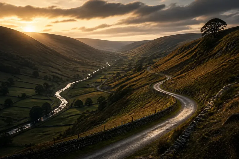
Why county roads follow the ground becomes plain when a road bends across a hillside rather than climbing straight over it. On a contour map, that curve can reveal how the route meets a slope, stream or ridge—and why the shortest line between two places may not be the easiest one to travel.
What does a valley do to a road?
A valley forms a natural corridor through higher ground. A road may follow its length, using the gentler passage between slopes, while keeping above the lowest ground beside a stream. The valley floor can be damp or crossed by tributaries, so the road need not hug the water to follow the valley’s shape.
On a map, compare the road with the stream and the contour lines. If the route broadly parallels the water while higher ground rises on both sides, it is likely following the valley. Watch for a change of bank, a bend around a tributary or a short climb out of the low ground: each marks a point where the valley’s shape may leave little room for a straight course.
Valley roads can connect settlements and farms along the same drainage corridor. Their course may become less direct where the valley narrows, a steep bank interrupts the line, or a stream cuts across it. The route’s bends make more sense when you follow the whole corridor rather than inspecting a single stretch.
Why does a road cross a slope diagonally?
A direct line up a hillside can meet steep ground. A diagonal route gains height more gradually, even if it covers more distance on a flat map. On a contour map, closely spaced lines indicate steeper terrain; wider spacing indicates a gentler slope. A road crossing contours changes elevation, while one that follows them for a stretch stays at roughly the same height.
Curves may mark a shift towards gentler ground, but their shape alone cannot tell you how or when the road was made. Compare the bends with the contour spacing across the entire hillside. A route may climb in several traverses before turning towards a pass, farm or settlement.
Say you are tracing a county road from a village in a valley to a farmstead on a shoulder above it. On the map, the straight line meets a patch where contours bunch tightly; the road instead bends across a flank where they spread out, then turns towards the farmstead. The observable result is a longer route that crosses the height lines in stages, rather than cutting through the steepest patch.
Where might a road use a ridge?
A ridge separates neighbouring slopes or valleys. A road can follow a broad crest, track a shoulder beside it or cross through a lower gap called a pass or col. To spot the pattern, look for high ground with slopes descending on both sides. Streams may run away in different directions from the ridge.
A ridge is not automatically the easiest line. A sharp crest can make a difficult route, while a broad top or a low crossing may offer a more continuous passage. A road on the ridge may also leave a settlement below it, requiring a separate descent. Follow the contours beyond the immediate bend to see whether the road is tracking the high ground or crossing it.
Which map clues distinguish a valley, slope and ridge?
How can you tell whether a road follows a valley?
Check whether it runs along a low corridor and broadly parallels a stream or river, with higher ground on both sides. If the road leaves the water or climbs away, follow the wider valley shape before deciding whether its course has changed.
What do contour lines say about a road’s climb?
Close contour spacing marks steep ground; wider spacing marks a gentler incline. A road crossing contours is changing elevation, while one running beside them for a stretch is holding roughly the same level.
How do you recognise a ridge route or pass?
Look for a road on high ground with slopes falling away on either side, or for a dip where the road crosses the ridge. Streams draining in opposite directions can help identify the divide between valleys.
Can the land explain why a road was built?
The terrain can show what constraints a route meets, but a map alone cannot establish the road’s history or original purpose. For that, compare the map with local records or accounts, and treat the shape of the land as one part of the explanation.
How should you compare a road with its surroundings?
Use a contour map alongside a map that shows streams and roads. Trace a stretch at a time, noting what the route does and what feature lies beside it. Then choose the next question from the pattern you see:
- The road parallels a stream in a low corridor: if higher ground rises on both sides, read the stretch as a likely valley route; if the road leaves the stream, trace the valley farther before judging whether it has changed course.
- Contours crowd together beside the road: if the road turns away from the tight spacing, compare its new line with wider-spaced contours; if it continues through them, check the map’s elevation pattern before calling the section a gentle climb.
- The road crosses contour lines at an angle: if the lines spread out along the crossing, note a gentler traverse; if they remain tightly packed, look for a nearby bend, gap or alternative flank.
- The road runs across high ground: if slopes fall away on both sides, check whether it tracks a ridge; if it passes through a dip, look for a route across a pass or col.
- The road changes from low ground to a climb: if a tributary gap or gentler flank lies ahead, follow the route towards it; if neither appears, widen the map view and inspect the full slope.
- The road’s line seems to contradict the terrain: if the map scale hides local detail, consult a larger-scale map; if the pattern remains unclear, keep the interpretation open rather than assigning a single reason.
For instance, imagine a reader has a contour map and a stream map open at a county road that leaves a valley. The reader sees the road parallel the stream, then cross it near a tributary; beyond that point, the route bends across wider-spaced contours before reaching a ridge dip. The resulting reading is a valley approach followed by a gentler slope traverse and a ridge crossing—not one unchanging type of route. If the tributary or contours are absent from the map, the reader should leave that part uncertain and check a more detailed map.
For anyone asking why county roads follow the ground, the useful habit is to track how the route changes as the land changes. A road can follow a valley, traverse a slope and reach a ridge in one continuous journey. The point where one pattern gives way to another is often where the map offers its clearest explanation of the route’s shape.