Reading an Old County Map Without Treating It as the Whole Story
Reading an old county map closely helps you identify its symbols, date and purpose, then describe a place with claims the map can actually support.
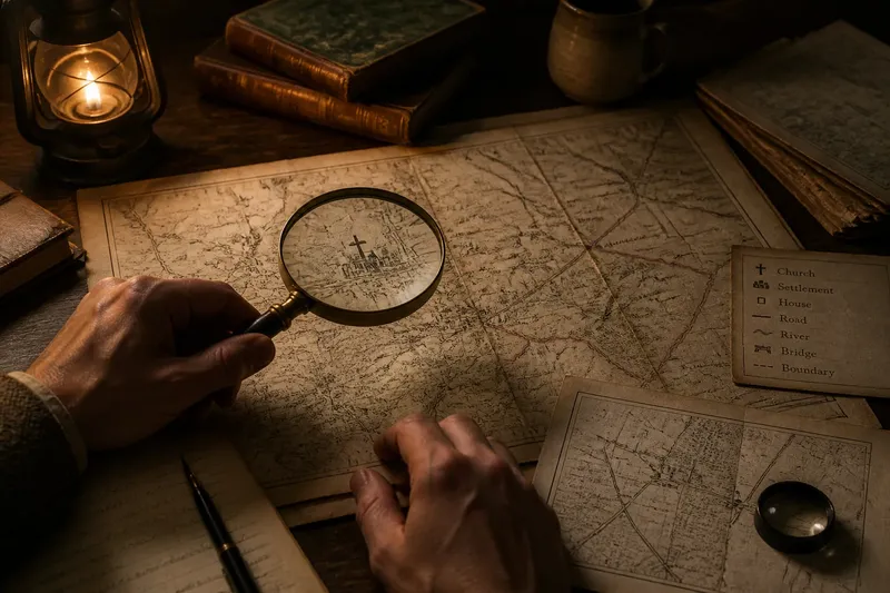
Reading an old county map often begins with a practical puzzle: is that faint line a road, a parish division or simply a mark left by the printing process? The answer depends on the map’s purpose and conventions, so start with what the sheet itself tells you before assigning meaning to its details.
What does an old county map show clearly?
Begin with the title, legend, imprint and any notes around the map. These can identify its intended audience and explain symbols, but the map’s layout also offers clues. A sheet made to help travellers may foreground roads; one accompanying a county history may label places discussed in the text. Treat those clues as context, not a complete account of the landscape.
Check whether you are viewing an original, a later edition or a digital reproduction. A catalogue record may distinguish a survey date from publication details, while folds, faded ink or a cropped image can make lettering hard to read. If the date is unclear, describe it as uncertain rather than choosing a precise year.
How should you read symbols and place names?
Use the legend where one is provided, then inspect how the same mark appears elsewhere on the sheet. A building symbol might stand for a church or a settlement, depending on the map’s conventions. Likewise, a label placed near a river or village may have been shifted to avoid crowding, so its position does not always pinpoint the feature.
Read names as printed before interpreting them. If a letter is blurred or an old spelling is unfamiliar, record the uncertainty and compare the form with another source from a relevant period. Avoid silently replacing an older spelling with a modern one; that erases a useful clue about how the map presents the name.
Say you are examining a digitised county map whose legend marks churches with a small cross. The cross beside “Merefield” is clear, but the label sits between two clusters of buildings. You can record that the map marks a church near Merefield, then check a parish map or local directory to see whether either cluster can be identified more closely.
What can an unmarked space tell you?
Not every feature made it onto every map. Small settlements, minor lanes and local names may be absent because the sheet is simplified or aimed at a particular reader. A blank patch therefore describes the map, not necessarily the ground.
Compare the map with a source suited to the question. An estate plan may show buildings and land divisions; a gazetteer may help identify a named place; a parish record may offer evidence about local usage. Each source has its own scope, so look for agreement between sources that describe the same kind of thing.
How can you use an old county map responsibly?
Keep a concise note of the map’s title, stated date or edition, collection or map series, and the detail you are using. Then separate the visible evidence from your interpretation: “The map labels the place as…” reports what is printed; “the settlement was known as…” makes a wider claim that may need additional evidence.
- Observation: The title names a county and a road network. If your question concerns travel routes, then use the roads as relevant evidence; otherwise, seek a map made for your subject.
- Observation: The imprint gives a publication date but says nothing about when the survey took place. If you need to date a feature, then look for a survey note or a dated comparison; otherwise, describe only the publication date.
- Observation: A symbol is explained in the legend and used consistently. If its meaning fits the feature you are describing, then report that reading; otherwise, call it an unexplained mark.
- Observation: A place name is partly obscured by a fold or poor reproduction. If another clear copy or source confirms the reading, then cite that support; otherwise, give the uncertain letters or leave the name unresolved.
- Observation: A small settlement is absent from a county map that labels only larger places. If you need evidence about smaller communities, then consult a more detailed local source; otherwise, state only that this map does not show it.
- Observation: A line resembles a parish boundary but has no clear key. If a parish map or written record identifies it, then use that corroboration; otherwise, describe it as an unidentified line.
Imagine a researcher has a hypothetical map labelled “revised edition”, with no survey date, a clear church symbol and a faint line beside a village. They note the title and edition, transcribe the village name as printed, and check the legend: it explains the church symbol but not the line. They then compare the area with a parish map, which identifies a boundary in that position. The sound result is to report the church as mapped and the line as a likely parish boundary supported by the second source—not to claim the county map alone proves its identity or date.
Which questions help with an old county map?
Does a line mark a county or parish boundary?
Check the legend and any explanatory notes before naming the line. If they do not identify it, compare with a map or record that explicitly shows the jurisdiction in question.
Can I use the map to date a settlement?
The map can show that a place appears in that particular edition, but its survey and publication dates may differ. Use a dated source that addresses the settlement directly if a more precise claim matters.
Should I match an old place to a modern map?
A modern Ordnance Survey map can help you orient yourself, but roads, names and boundaries may have changed. Look for several corresponding features, such as a river bend and a nearby church, and keep the match tentative if they do not align clearly.
How should I cite a digitised map?
Give the title, stated date or edition, holding collection or catalogue reference, and the relevant sheet or area where available. Mention visible limitations, such as a cropped margin, when they affect your reading.
What wording keeps a map claim precise?
Use verbs that match the evidence: “labels”, “depicts”, “marks” or “does not show”. For instance, “This edition labels the settlement as Merefield” is narrower and more defensible than claiming that every local resident used that name.
For a disputed place name, boundary or location, seek help from the relevant archive or a local-history specialist. The useful point is not to make the map answer every question, but to let it guide the next one: which source could explain the detail this sheet leaves uncertain?
Reading an old county map carefully gives you a clear account of what is printed, plus a sensible route to the evidence that could fill its gaps. That distinction keeps the map useful without asking it to speak for the whole landscape.